 Catalogue PIGMA
/Physical Environment/Terrestrial Hydrography/Hydrographic Network
Type of resources
Available actions
Topics
Keywords
Provided by
Representation types
Scale
-
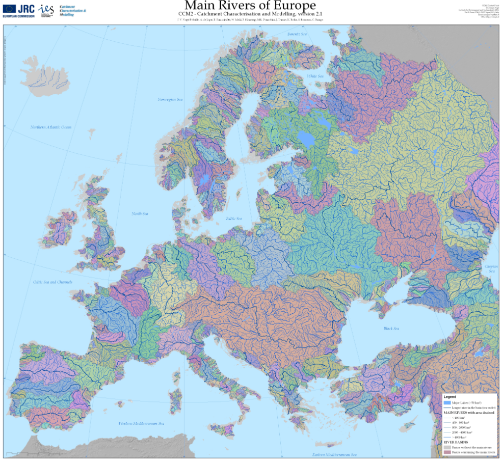
The Catchment Characterisation Model (CCM2) database covers the entire European continent, including the Atlantic islands, Iceland and Turkey. It includes a hierarchical set of river segments and catchments based on the Strahler order, a lake layer and structured hydrological feature codes based on the Pfafstetter system. It allows for analysis from the regional to the continental scale, corresponding to traditional mapping scales of up to 1:500,000. CCM2 covers an area of about 12,000,000 square kilometers and includes more than 2,000,000 primary catchments. These can be aggregated to drainage basins at different hierarchical levels, forming, for example, about 650 river basins of more than 1000 square kilometers. CCM2 further includes a coastline, fully congruent with the river basins, and some 70,000 lakes. The layers are generated from a 100 meters resolution digital terrestrial elevation model. The following layers are available: Seaoutlets: the major river basins, Main drains: the major rivers, Lakes: all surface water larger than 25x25 metres, Coastlines: coast line extracted from Image2000 imagery, River segments: Drainage channels from the primary catchments, Catchments: Primary catchments. This data-set refers to Lakes and River basins.
-
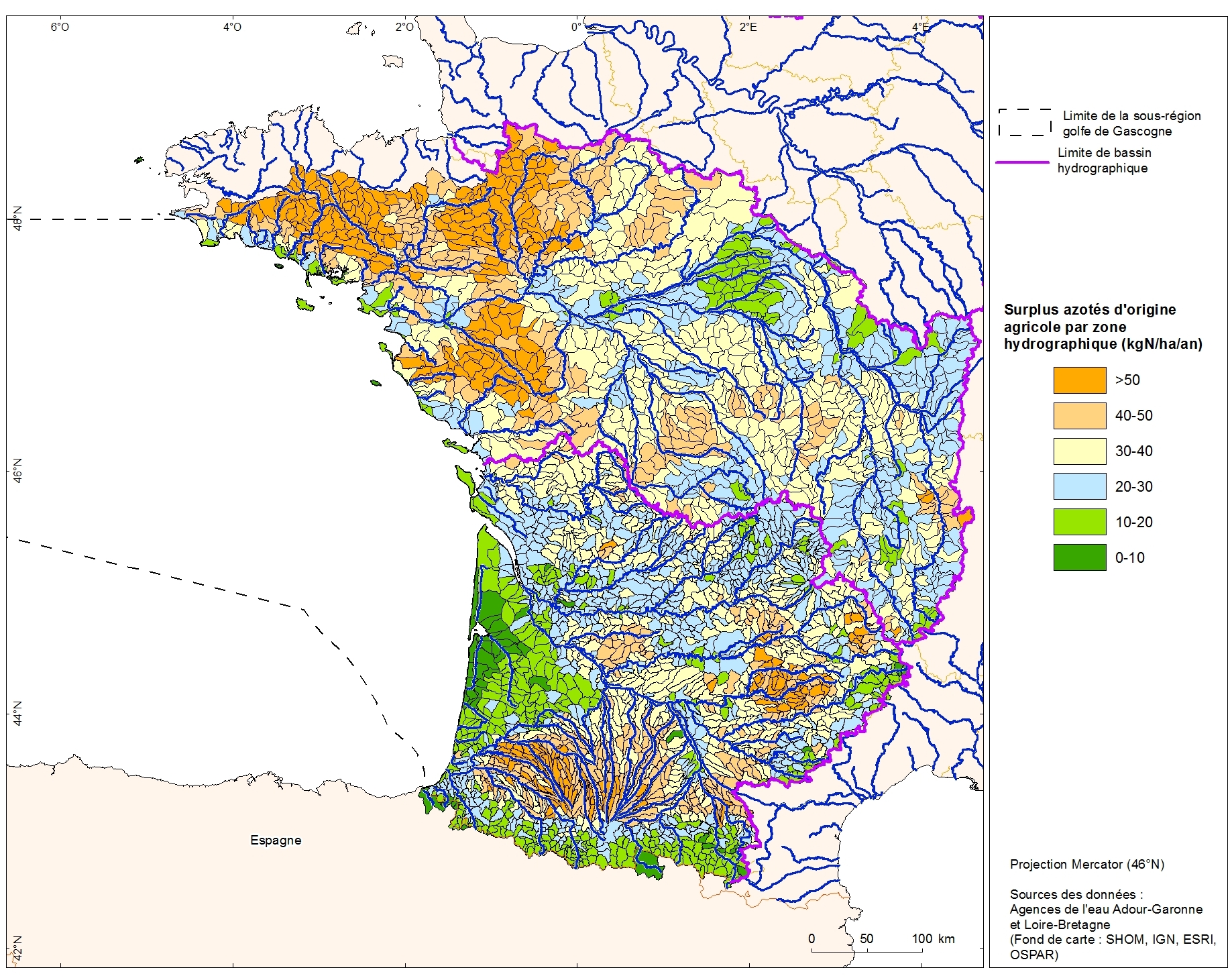
Excess nitrogen from agricultural drainage by hydrographic zone in the Adour-Garonne basin. This data was collected as part of the "initial state" phase of DCSSM with the Adour-Garonne Water Agency. Referent expert AAMP : Aurélie Blanck. Partial description of the fields: "kgN_ha_an" : nitrogen surplus (kgN / ha / year)
-
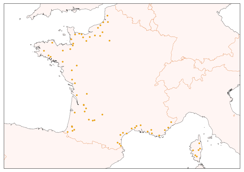
Physico-chemical monitoring stations are part of a network under the responsibility of the water agencies. Regarding the scope of strict thematic contribution "Hydrology," the monitoring stations do not come into account because they only measure the physico-chemical quality of the rivers. These stations are used only for calculations under fluvial inputs of pollutants / nutrients.
-
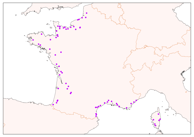
Selection of flow gauging stations of the French rivers (accessible via the central bank administered by the HYDRO SCHAPI) on the basis of hydrological function and monitoring stations. The data bank HYDRO stores measurements of water depth (variable time step) from 3500 stations (including 2400 which are currently in service) located on French rivers and provides access to descriptive data stations (main purpose, precise location, measurement quality, history, data available ...)
-
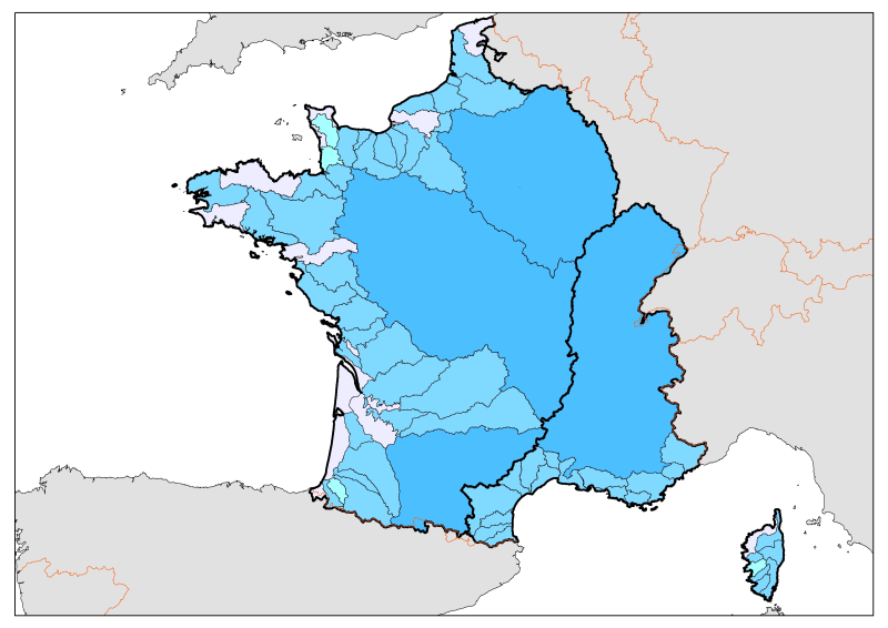
Division of French metropolitan territories to define the zones contributing to the pollutant flow carried by rivers to the sea.